*ABOUT US
Who We Are
Croft Surveying and Mapping is a proudly local surveying and mapping business in the New England and North West region of NSW. Croft Surveying and Mapping was formed by merging the expertise of Agri-GIST (GIS and Mapping) and John Hough Surveying. Michael Croft brings a host of surveying and mapping expertise to the area and able to draw on John Hough’s depth of experience in the surveying sector.
Michael has extensive spatial experience in land and engineering surveying, terrain modelling, design and analysis. He holds the qualifications of Registered Land Surveyor, Bachelor of Surveying, and Graduate Diploma in Geomatics (GIS), and has undertaken studies in marketing management. His experience in marketing project management (in the rural and horticulture sectors) has utilised the analysis of national datasets to provide essential focus areas for clients. Michael has undertaken a number of projects including site analysis at catchment scale, shopping centre management mapping and township flood studies involving large scale spatial data management. Furthermore, Michael has vast experience in more specialised fields of the land sector involving civil engineering works, design and volumetrics, satellite and aerial imagery analysis.
*ABOUT US
Meet the Team

Michael Croft
Bachelor of Surveying, G.Dip Geomatics (Geographical Information Systems), Registered Land Surveyor, Member ISNSW
Michael is involved in survey, design, Geographical Information Systems/mapping, planning, property and procedural components. His interests include family, playing in a band, fine coffee and the outdoors. Michael established Croft Surveying and Mapping in 2009.

Elizabeth Parker
BA (Hons) LLB, Dip Legal Prac.
Elizabeth prepares survey documents for plans and easements; oversees the progress of matters; corresponds with clients and related parties; and answers the phone. Elizabeth has been working with Croft Surveying and Mapping since 2014.

James Croft
B.Ag
James is involved in the technical elements of field surveying for construction and boundary identification. He has a great understanding of the land and holds a great depth of local expertise and contacts. James has been working with Croft Surveying and Mapping since 2009.

Karl Bock
Masters of Geographic Information Systems, Bachelor of Urban and Regional Planning (Hons), Bachelor of Natural Resource Management (Hons) and Advanced Diploma of Horticulture
Karl prepares documents to accompany development application submissions for a range of town planning matters with councils and the Department of Planning. Karl is focused on achieving practical and feasible solutions that allow proponents to fulfil and improve their prospects. Karl has been working with Croft Surveying and Mapping since 2016 as permanent sub-contractor.

Simon Bailey
Dip. Surveying
Simon prepares a range of plans for surveying, engineering, mapping and design applications. Simon has been working with Croft Surveying and Mapping since 2010 as a permanent sub-contractor.

Jayne Croft
B.Ed
Jayne is involved in field surveying and document delivery. She is interested in family, art, travel and the outdoors. Jayne has been working with Croft Surveying and Mapping since 2009.
*ABOUT US
Community Engagement
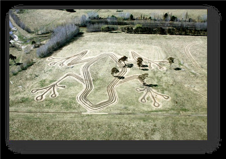
Southern New England Landcare undertook a giant tree frog revegetation project planted at “The Hill” Kentucky (NSW). Croft Surveying and Mapping was able to take the concept landscaping design and position it on the site. When complete, the project was approximately 400m long. Local schools were involved in the planting.

Croft Surveying and Mapping has regularly represented the surveying industry at local careers festivals, sharing with students and teachers about the surveying profession – a life without limits.
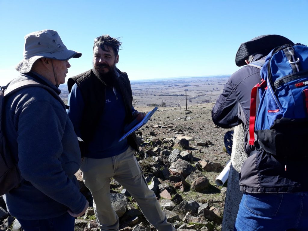
A group of 26 University of the Third Age (UO3A) walkers ascended Mount Harnham (located at Salisbury Plains south of Uralla, NSW) and were able to use surveying equipment from the trigonometric station to view the landscape from Ebor to Narrabri. Michael Croft provided an explanation of the trigonometric station network across the state (walkers braving the bracing July wind gusts at 1255m elevation).